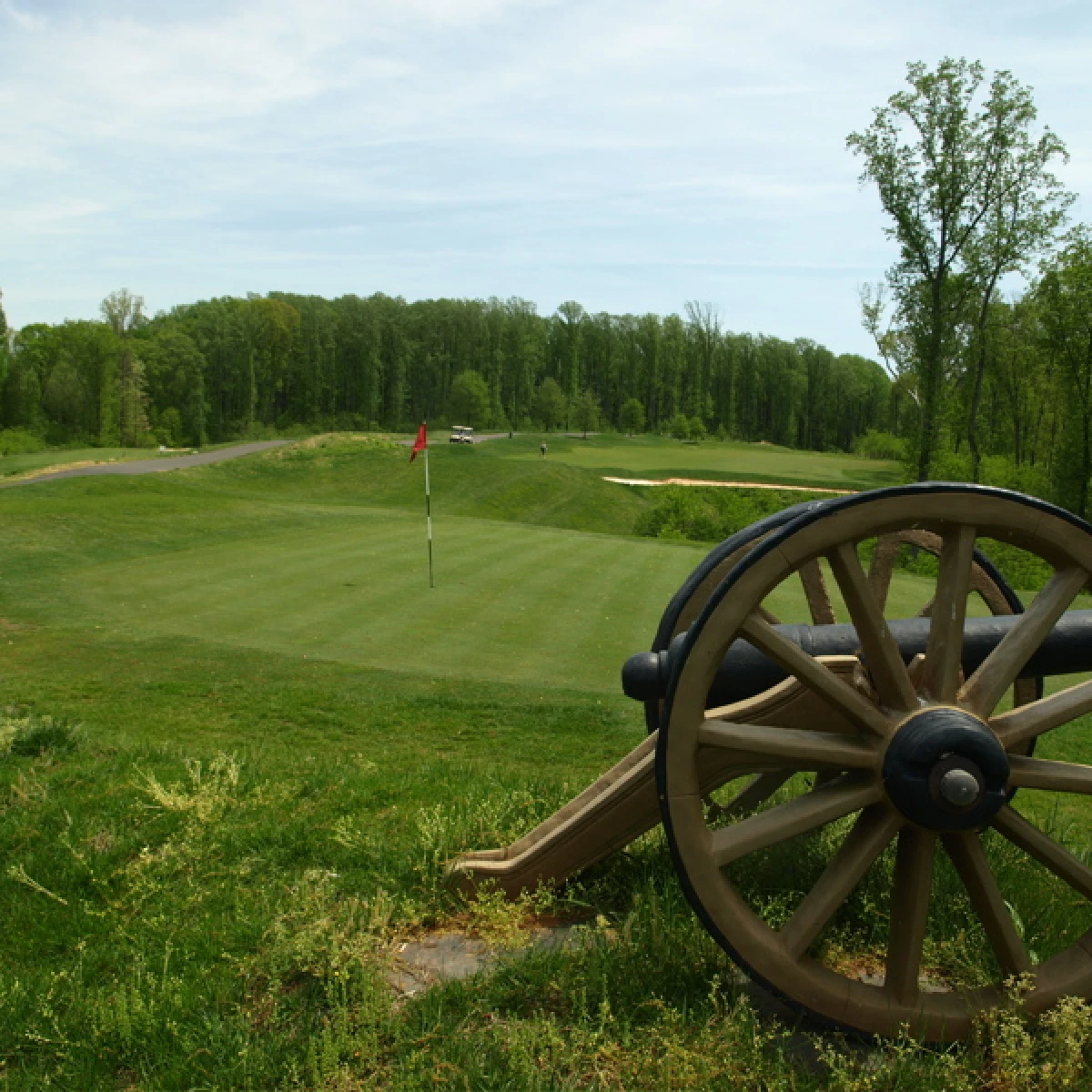
Cannon Ridge during its golf-course years. Image supplied with the original article.
Stafford County has an opportunity to shape the future of a landscape that connects local history, the Rappahannock River and the possibility of a regional park.
At the southern end of Celebrate Virginia North, the former Cannon Ridge Golf Course has become the focus of competing visions: residential development or preservation for public recreation and historic interpretation.
Save Stafford believes the County should give the preservation vision a clear place in its long-range planning.
The immediate question is straightforward: Should Stafford identify Cannon Ridge as a priority for future park, trail, historic-preservation and public-access opportunities?
There is a strong case for doing so. Recognizing that priority would give the County a direction while it investigates ownership, development rights, costs and possible preservation partnerships. It would not, by itself, secure the land or open it to the public.
A landscape connected to nationally significant history
The Banks Ford area was part of the Chancellorsville Campaign in May 1863.
After capturing Marye’s Heights at Fredericksburg on May 3, Union Maj. Gen. John Sedgwick’s VI Corps moved west toward Joseph Hooker’s army. Fierce fighting at Salem Church blocked the advance and left Sedgwick’s command exhausted, with Confederate forces pressing it from three sides and the Rappahannock River at its back.
The pontoon bridges in the Banks Ford area became the corps’ critical escape route. Before dawn on May 5, Sedgwick withdrew roughly 18,000 men across the river, avoiding the destruction or capture of a large part of his command by a Confederate force that substantially outnumbered it.
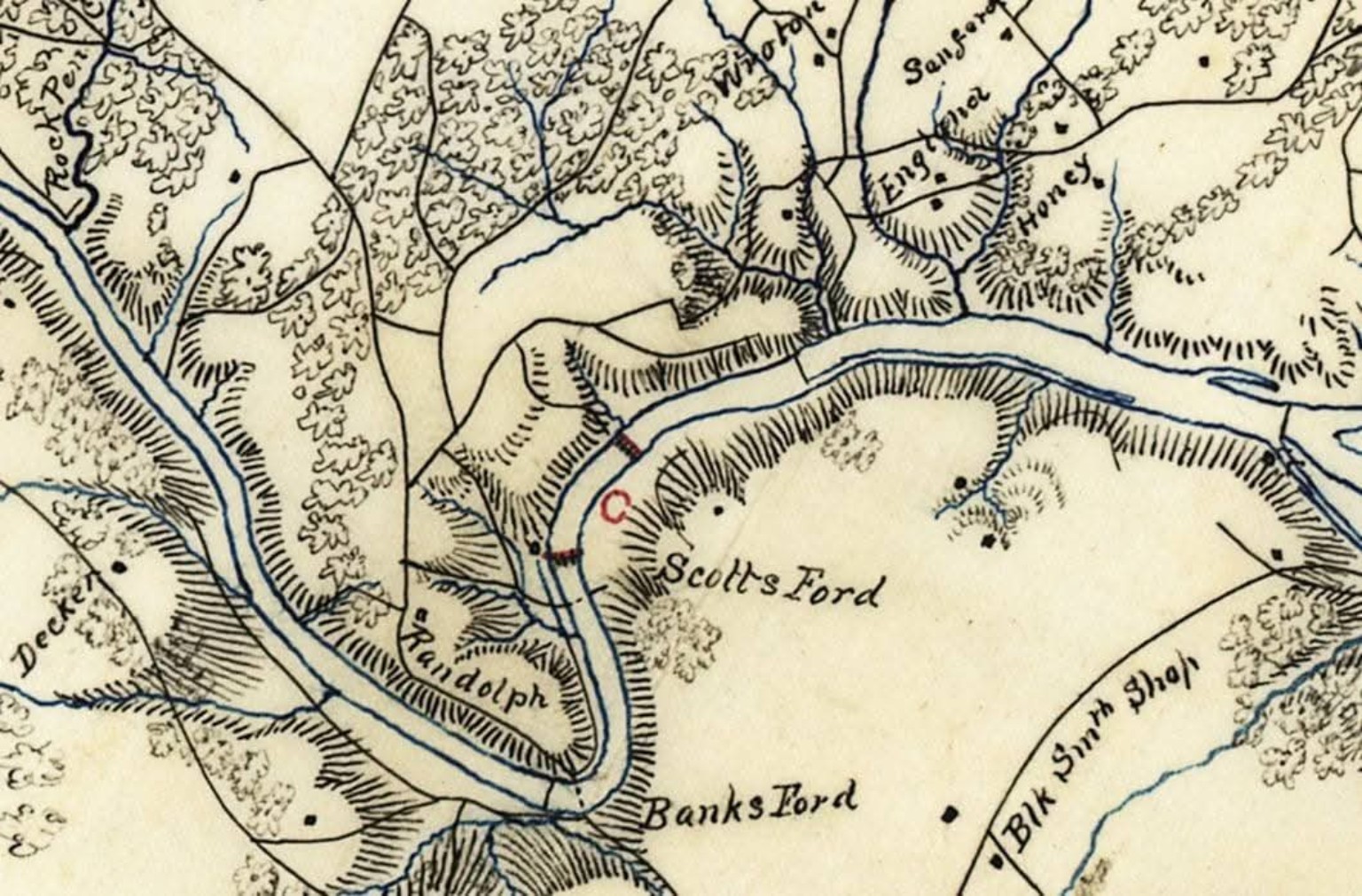
A historic map of the Rappahannock River identifies Banks Ford and nearby Scott’s Ford. Map supplied for this article.
The National Park Service’s battle account identifies two pontoon bridges at Scott’s Dam; its broader campaign interpretation describes Sedgwick’s escape through the Banks Ford area. These nearby crossings belong to the same larger battlefield story. National Park Service battle account, NPS campaign interpretation.
A park associated with Cannon Ridge could help residents understand how Fredericksburg, Salem Church, Chancellorsville and the river crossings were connected. Trails, overlooks and carefully researched interpretation could make that history easier to experience on the landscape.
More than a Civil War story
The historical importance of the surrounding area has been recognized for decades.
A Stafford historic-resource study held by the Virginia Department of Historic Resources includes preservation documentation associated with Celebrate Virginia. It identifies the Banks Ford Unit, the Salem Church Battlefield Historic District and archaeological properties as resources considered in the development review process. Stafford historic-resource study.
Across the river, Fredericksburg’s planning records describe a broader landscape of historic crossings, canal features, earthworks and Indigenous archaeological sites. Those records concern the Fredericksburg side of the corridor; they do not establish which resources fall within the Cannon Ridge property. Fredericksburg’s Celebrate Virginia/Central Park plan.
That distinction should guide the next step. A parcel-level historical and archaeological review could establish what can be protected directly, what might be connected through agreements, and which stories a future park could responsibly tell.
A trail connection Stafford has already envisioned
The trail idea has a foundation in County planning.
Stafford’s Comprehensive Plan, in the version revised October 21, 2025, describes a proposed Cannon Ridge Trail linking existing pedestrian trails in Celebrate Virginia North with the Belmont–Ferry Farm Trail through proposed routes along the Rappahannock River. Stafford County Comprehensive Plan, Section 4.4.7.
The next opportunity is to build on that concept: evaluate Cannon Ridge as a potential park and access point within a larger network of trails, historic places and natural areas.
A future park could offer walking and cycling routes, interpretive signs, places to pause by the landscape, and connections to neighboring resources where ownership and preservation agreements allow. Any public route would require approved access and a design that protects sensitive sites.
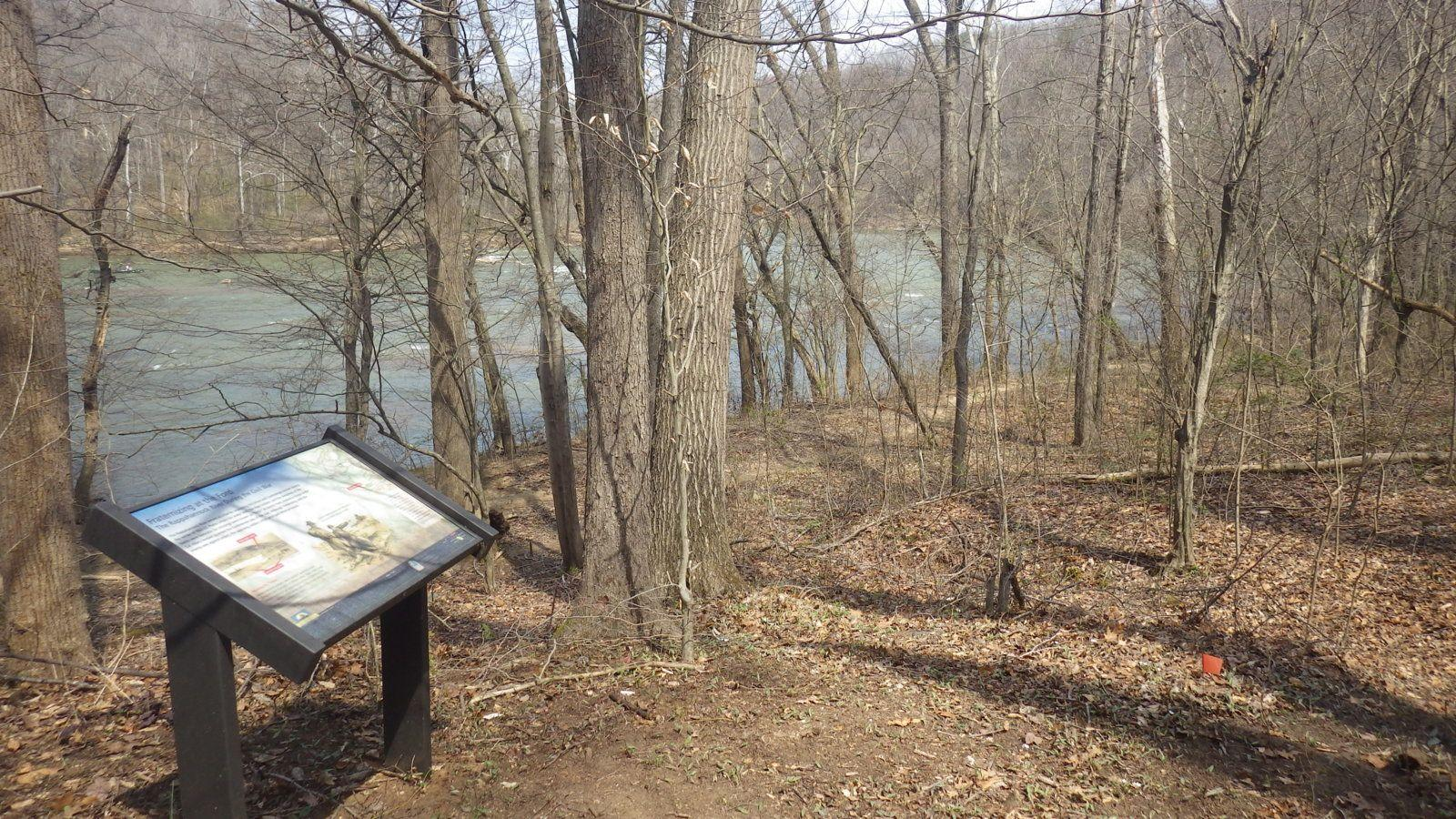
Interpretation beside a wooded riverbank illustrates one way to bring history outdoors. Supplied reference photo; location has not been verified.
An existing recreation site deserves a closer look
The former golf course may offer a useful starting point for park planning. Existing cart-path corridors and recreational facilities could potentially support a new use.
Their value depends on their present condition. Engineers and park planners would need to assess pavement, drainage, buildings, utilities, accessibility and safe connections before estimating how much could be reused.
The original proposal describes approximately seven miles of paved paths. That figure needs verification, as do the costs of adapting and maintaining them. The case for studying Cannon Ridge does not depend on calling it an instant park. It depends on understanding whether existing features could make a future park practical.
A planning priority is a first step
Virginia law describes a comprehensive plan as a general guide to a community’s physical development. It also requires localities to consider natural resources, historic areas, public facilities and other conditions when preparing that plan. Code of Virginia § 15.2-2223, § 15.2-2224.
Identifying Cannon Ridge as a future preservation and recreation priority would express Stafford’s intent. Acquisition, easements, funding and any necessary land-use actions would still require separate work and decisions.
The designation should not be presented as a guarantee of protection or as a substitute for reviewing existing development rights. Its value is practical: it gives officials and potential partners a clear objective to pursue.
Stafford should establish that objective while a preservation opportunity can still be evaluated.
Development pressure gives the discussion urgency
In December 2024, Potomac Local reported that an August 2019 administrative decision allowed 579 residential units on the former Cannon Ridge property. According to the County explanation quoted in that reporting, the concept-plan amendment was considered non-material and did not require additional public hearings. Potomac Local’s December 23, 2024 report.
That reporting documents a past decision, rather than establishing the project’s current approval or construction status. Stafford should provide an up-to-date public account of the property’s development rights and pending applications as part of any preservation discussion.
The underlying concern remains: a former golf course is not guaranteed to remain open space. As development advances, the possibilities for a connected park may narrow.
Preservation partners could help
Protecting Cannon Ridge would require a realistic financial strategy. That strategy could explore nonprofit partnerships, donations, conservation or preservation easements, partial acquisition and public funding where eligible.
Virginia’s Battlefield Preservation Fund offers one avenue to investigate. Administered by the Department of Historic Resources, it makes grants to qualifying private nonprofit organizations to acquire eligible battlefield land or protective interests in it. The program requires permanent preservation protections. Eligibility for any Cannon Ridge parcels would need to be established. Virginia Battlefield Preservation Fund.
The program’s 2026 application deadline was September 1, 2026, and has passed. Future opportunities would depend on subsequent funding rounds and program requirements. The existence of the fund is a reason to explore partnerships, not a promise that an award is available for this property.
The useful question is what combination of resources could make protection achievable—and what ongoing responsibilities Stafford or its partners would need to accept.
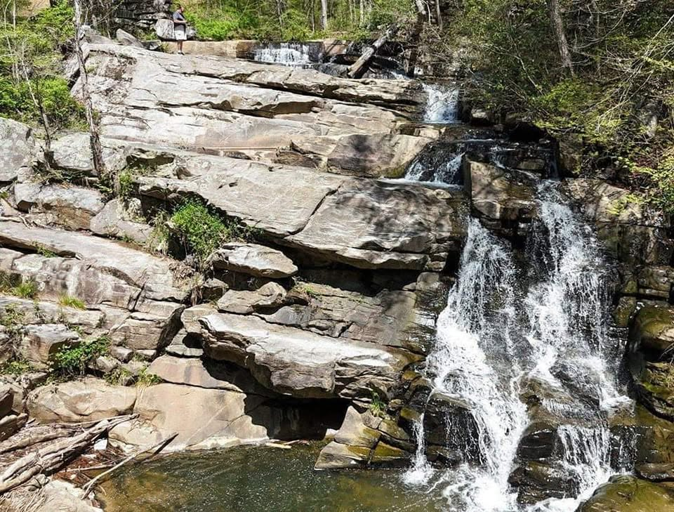
A rocky cascade illustrates the outdoor character of the supplied proposal. Reference photo supplied for this article; its location and relationship to Cannon Ridge have not been verified.
Growth should include decisions about what to preserve
Stafford’s future will be shaped by both development and the places it chooses to protect.
A Cannon Ridge park could add to the region’s historic and outdoor destinations, provide recreation for residents, and give visitors another reason to spend time in Stafford. Those possibilities deserve examination, without assuming attendance figures or economic benefits that have not been studied.
The County should begin with concrete questions:
- What are the current ownership, parcel boundaries and development rights?
- Which historic and archaeological resources lie within the property?
- What public access and trail connections could be secured?
- What would acquisition, improvements and annual maintenance cost?
- Could a nonprofit partner, an easement or a partial acquisition make preservation feasible?
Answering those questions would allow residents and officials to judge a real proposal.
Keep the opportunity in Stafford’s long-range vision
Cannon Ridge deserves consideration as part of a larger landscape: the Rappahannock River, historic crossings, battlefield terrain, archaeological resources and possible trail connections.
Save Stafford supports identifying the property as a preservation and recreation priority in the Comprehensive Plan, followed by a transparent feasibility review and discussions with the landowner and potential partners.
Residents can ask County leaders to build on the existing Cannon Ridge Trail concept, explain the property’s current status, and evaluate a future park before the opportunity becomes more difficult to pursue.
Stafford does not need every answer today to decide that Cannon Ridge is worth a serious effort. It needs a clear commitment to find those answers.
Sources, documents & image credits
Read the original record
National Park Service battle accountReviewed September 10, 2026 · Open original source ↗NPS campaign interpretationReviewed September 10, 2026 · Open original source ↗Stafford historic-resource studyReviewed September 10, 2026 · Open original source ↗Fredericksburg’s Celebrate Virginia/Central Park planReviewed September 10, 2026 · Open original source ↗Stafford County Comprehensive Plan, Section 4.4.7Reviewed September 10, 2026 · Open original source ↗Code of Virginia § 15.2-2223Reviewed September 10, 2026 · Open original source ↗§ 15.2-2224Reviewed September 10, 2026 · Open original source ↗Potomac Local’s December 23, 2024 reportReviewed September 10, 2026 · Open original source ↗Virginia Battlefield Preservation FundReviewed September 10, 2026 · Open original source ↗Support Save Stafford
Independent local information. No paywalls. No advertising.Research like this takes time and sometimes requires obtaining public records. Community support helps Save Stafford continue making this information freely available.
No subscription required. Contribute only if you choose. Financial contributions do not purchase editorial influence.